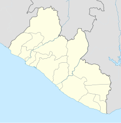
Paynesville, Liberia
Paynesville | |
|---|---|
| Coordinates: 6°17′N 10°43′W / 6.283°N 10.717°W | |
| Country | |
| County | Montserrado County |
Paynesville (sometimes Paynesward) is a suburb east of Monrovia, Liberia. It is geographically larger than the city of Monrovia. It is expanding eastward along the Robertsfield Highway and northeastward beyond Red Light Market, one of the largest market areas in Liberia. Paynesville is often considered a part of the Greater Monrovia area. It was the location of the Paynesville Omega Transmitter, the highest structure in Africa, until the tower's demolition in 2011. The Liberia Broadcasting System is also located in Paynesville.[1] The Liberian Judo Federation is based in Paynesville. The Montserrado county School System office is looked in Paynesville, at vokar Mission[2]

Neighborhoods
[edit]Paynesville has several neighborhoods, called "communities" by residents, which are notable for their unique names. Some communities include housing estates, and older settlements, while others are named after landmarks, major boulevards/roads or local leaders. Others predate the street names altogether.
- A.B. Tolbert Community
- Duport Road
- ELWA
- Gobuychop
- Grayja
- Kendeja
- Kenny Town
- King Gray Town
- Nizohn
- Parker-Paint
- Plofe
- Police Academy
- Red Light Market
- Rehab Road
- Peace Island
- SD Cooper Road
- Sinda Town
- SKD Boulevard
- Stephan Tolbert Estates
- Wamba Town
- GSA Road
- Soul Clinic
- Nathaniel Ballah Community
- FDA Community
- Wien Town
- Morris's Fram Community
Notable residents
[edit]- C. Cyvette M. Gibson
- George M. Weah
- Joseph Boakai
- Prince Johnson
- Archie M. Luo
References
[edit]- ^ http://liberiabroadcastingsystem.com/news/article_2008_11_19_3402.html Archived 2014-02-02 at the Wayback Machine Liberian Broadcasting System, 2008-11-19, "Chinese Govt. Dedicates LBS Expansion Project" - Nov 19, 2008.
- ^ Liberia / IJF.org

